Saturday, April 14, 2012

Buckeye/Caney Loop April 6-7

With lows in the upper 40's and highs in the low 70's I just had to get out one more time.
I left home at my usual o' dark thirty (4 AM) and arrived at the Buckeye TH at 8 AM.  Four hours isn't really a long drive, but I sure wish I lived closer....maybe when I retire:) After several fun hiking and paddling trips with friends it was time for some solitude. It was a pleasant 52 degrees as I headed out, and while the trail's namesake were just about past peak bloom, I did find a few,especially as I moved down from the ridge.
Red Buckeye Aesculas pavia
Ohio Buckeye Aesculus glabra
 Spring's come early this year and the trail was already nearly overgrown in places.
The early morning view from the ridge
  I stopped for lunch a little before noon by the big leaning pine and then about a half hour later ran into another solo hiker making his way up the trail. It was taedawood. We'd crossed paths about a year before on Caney but were both in "walking meditation" mode, and only said a brief hello and kept going. He spotted my Hammock Forums sticker on my car at the TH and left a note. He didn't know the car belonged to the solo hiker he'd passed, and when I saw his signature, I recognized his trail name from the forums. This time we recognized one another and stopped to introduce ourselves and chat for a while. You meet the nicest people on the trail!
 lunch stop
Another solo traveler on the trail
 Ozark Spiderwort Tradescantia ozarkana (I think)
I headed down to the junction then west down Caney about a mile and a half before heading back and making camp for the night across the creek at Katy Falls.
Absolutely no idea :)
Once in camp I hung my hammock and stretched out to take in the trees and sky.  There were a few mosquitoes out briefly around dinner time and one bit through the back of my shirt (spray shirt with permethrin next time)  but they quickly vanished as the temperature dropped. No need for the tarp, clear skies and a full moon made for a wonderful night in the woods.The next morning dawned crisp and cool, the birds were singing and I dawdled around camp exploring the creek and some side trails.
 Hawthorne species unsure,still researching
 
more unknown but cool fungi
Bird's Foot Violet Viola pedata
It was a beautiful weekend to be in the woods. I made it back to the east TH around 1:30 and it seemed a lot warmer than 73 when I finally made it up the road to my car. Had I stuck to my original 3 day plan I would have made this trek early in the day,but I decided to have a day at home to look up all the plants I'd seen, and catch up on chores around the house.
The bugs were not bad yet, but soon will be . I'd taken a headnet and small bug net for the hammock but didn't have to resort to either. Permethrin on clothes and gear really seemed to help; no chiggers or ticks. I did have to exercise caution with poison ivy but long pants were sufficient to step off trail to investigate something. For over 50 years I never reacted to the stuff, but a few years back I pushed that too far, and now I do end up with a slight rash if I'm not careful.

Phlox-unsure of species
If anyone can id the unknown shots above, or if I've misidentified something, please email or pm me so I can correct it, I'm a tree geek and I'm just getting into id'ing wildflowers, and don't know any fungi :)
Some of the flowers I saw that I didn't photograph were:
False Solomon's Seal Maianthemum racemosum (not in bloom)
Wild Comfrey Cynoglossum virginianum
Blue Phlox  Phlox divaricata (everywhere)
Dwaft Crested Iris Iris cristata not likely the rarer Iris verna


There are more plant shots here, but I'm still in the process of adding captions:
https://picasaweb.google.com/liveoutsidelady/BuckeyeCaneyLoopFloraAndFaunaApril67?authuser=0&authkey=Gv1sRgCJHAr4rLhMHO8QE&feat=directlink

Saturday, March 24, 2012

Spring Break FL 2012

I was actually halfway lamenting the fact that I had chosen to join my northern Michigan friends, Lois and John, for another paddling trip to Florida; I was regretting not going backpacking. I really hadn't spent as much time on the trail  as I'd wanted this season and it was quickly coming to an end with the warm weather....at least nearby weekend trips.

Silly me! The trip was great fun and the weather was perfect. The drought had however taken its toll on the rivers and we spent most of the week on larger spring-fed rivers or their tributaries.  Lois and John serendipitously found a wonderful townhouse for the week. They had arranged to rent a house in Dunellon for the following week and while chatting with the owner it came up that they still hadn't found a house in Tallahassee. The owner, a lobbyist, mentioned that he had a townhouse there that he didn't normally rent, but wasn't using that week and we got it for a steal. It was in a beautiful part of town and was really nice, even had a bottle of wine waiting for us!
Monday 3/12
Our first paddle was on the Wacissa river from the head springs to Goose Pasture, about 9 miles. It starts out as a wide river, with twelve springs contributing to its flow, then braids between islands. The eel grass and other aquatic vegetation was easy to see in the clear spring water. Farther downstream the water became more tannic and we saw  several alligators. A young one about 5 ft swam beside my boat for a ways but the picture I got was unfortunately a little blurry. Another highlight of the trip was going through a long defunct section of dam (no safety hazard) and we could hear "whitewater", actually shallow riffles, in advance :D. The day was mostly cloudy with temps in the high 70's and a little windy. We saw osprey, limpkins, egrets, several types of herons, an eagle, and a few hawks, but no kites, which I was really hoping to see. The mullet were jumping all around, one hit Lois' boat, and it made me reminisce about how delicious smoke mullet is. There were a few other paddlers out to see the springs, but once we headed down river, we had it all to ourselves.
Slipping quietly down a finger of the Wacissa River
Tuesday 3/13
John woke complaining of a painful tennis elbow like strain, so he and Lois decided to go for a 40 mile bike ride,(John rides a recumbent) and I decided to hike. My plan was to try to hike two nearby areas along the Apalachicola River bluffs. I began at Torreya State Park and hiked only two miles before the temp reached 84 degrees. Instead of heading to my other destination, one that required more strenuous hiking I decided to head back to Tallahassee and catch up on some errands that I knew I wouldn't have time to do on the way home.
Overlooking the Apalachicola River from the Torreya Bluffs
Hiking the bluffs. Who says Florida's flat?
Maidenhair ferns along the ravines
Wednesday 3/14
We headed to the Ochlockonee River to paddle what was suppose to be a 15 mile paddle. I thought a trip that long was a bit odd due to John's arm but he was fine. The river started out wide, then narrowed. Fifteen miles is a good day, but this river seemed to go on with no end in sight. John and I had a discussion about what we thought our speed was, trying to calculate when we'd be done, and as the clouds began to mass into cumulonimbus, complete with anvil I started to get a little concerned. Finally we all let out a big woohoo when our vehicle came into view after 6 hrs of paddling, AND, we made it off the river in time to miss the afternoon thunderstorm that dumped nickel size hail in the area, not to mention the accompanying lightning. We saw a couple of eagles, no other paddlers, and a couple of fishermen at the end of the trip. This may have been due to the fact that most sane people don't pick a 20 mile stretch for a day trip :) A few days later, while Lois was on the phone with a local paddler about joining us, he mentioned that the guide book was wrong and that section was actually 20 miles! We had NO trouble believing him.
Windless day on the Ochlockonee River
Bald Eagle on the Ochlockonee
Thursday 3/15
After our marathon paddle the day before, we decided to do a short five mile section of the Sopchoppy River, which turned out to be the best paddle of the week! Swift water, tight turns, a few drag overs, white sand bars, and beautiful tannin-stained water. The swift part isn't visible in the pictures as I was too busy negotiating turns to take any :) Cypress knees formed sentries along the shoreline and the high banks were lined with wild azalea, mountain laurel and ti ti.  This river is rumored to be up for Wild and Scenic designation and I can certainly see why. There was not a house in sight on the entire section and no other paddlers. We drifted in silence feeling a million miles from civilization....my kind of day!
Looking down from the "put-in" which you can't, btw, get any idea of its steepness.

Some of the many cypress knees lining the Sopchoppy River
Our lunch spot. The Sopchoppy's a typical north FL blackwater river
Friday 3/16
The end of the week arrived all too quickly and for my last river,we decided to paddle the Econfina, which two years before had been at flood stage. We'd paddled through the trees trying to stay in the main channel and not get lost. Unfortunately the gauge showed a measly 30 cfs and the guidebook recommend at least 140 cfs. Lois suggested the Wakulla, which we'd paddled before, and despite the chance to see manatees again, I wasn't in the mood for another wide river. John suggested the next lower section of the Sopchoppy, another 5 mile stretch that only begins to have houses just before the take-out.
This section was a little wider, the banks a little higher, and beautiful. Once again we paddled beneath wild azaleas and fringetree. We had the river to ourselves again and only one drag over. 
The only downside to the Sopchoppy are the put-ins and take-outs. Hauling a boat up a ridiculously steep goat trail covered in slick as owl snot fallen live oak leaves, was great fun and there was no shortage of groaning and moaning, and giggling....I told Lois I was going to enter her in the Sopchoppy worm grunting festival...yes this was on a sign as we went through town! I was just glad I had a fairly light canoe and not a heavy kayak. Putting in was on the other hand, a piece of cake! John made the comment "just pretend you have an unruly German Shepard on the other end, plant your feet, get a good grip and hold on. I was glad for a change that my painters were so long! This is also the man who was at the ready with camera to hopefully catch a shot of one of us as we fell in the river :) Fortunately no one did.
Putting in was much easier than taking out! Picture courtesy of John Heiam
Lois paddling past Fringetree
Mountain Laurel petal on water, Sopchoppy River. Courtesy John Heiam (the real photographer)


Saturday 3/17
On the trip from Texas to Tallahassee I'd taken my time, stopping in south Louisiana to have lunch, grabbing several lbs of crawfish tails on Saturday to take back home. Sunday morning I hiked at a preserve near Grayton beach, then took the long way along the coast and up through the Apalachicola National Forest. 
The trip home was a quick 13 hr drive with just a few stops for gas and stretching. I'd entertained the thought of stopping in Lafayette for the evening to catch Andrew Skurka speaking at the Pack and Paddle, but I was ready to be home.

What I'd started out dreading ended up a wonderful trip and next year Lois and John are talking about heading back to the Pensacola area which is not only closer for me, but if the weather cooperates, I'll get to paddle some of the rivers I missed three years ago when everything was truly at flood stage and not accessible. I'd love the chance to paddle the Blackwater River and to spend another day on Turkey Cr. After two years in the Tallahassee area, I'm ready to move on and explore some new rivers.
  

Sunday, January 1, 2012

Trail Angels, Eagle Rock Loop Dec. 28-30, 2011

Prologue: Life is nothing if not full of surprises! 

A friend and I had planned to hike the Ouachita Trail from Big Brushy to Queen Wilhelmina SP but the day before the trip I had to have an emergency root canal after cracking a tooth. Then, after we began, we'd hiked about 9 miles when she suffered a pulled muscle and was forced to quit. It could have easily been me instead, as I'm 16 years her senior. Fortunately she had cell reception and was able to call a friend that lived nearby. While we waited for him to pick us up, she checked the weather. The forecast had taken a turn for the worse, so after we drove to her car at the lodge, ate dinner, slept in our cars, and picked up our food cache the next morning, I headed home to regroup. I'm a firm believer that everything happens for a reason, so maybe we weren't meant to get caught in the middle of a forty plus mile trip in cold rain and temps only rising into the forties. 
Back home I started planning. Since I would now be solo, a loop would be easiest, and since I didn't get to do ERL at Thanksgiving because of high water, I decided to try again. What I didn't know was that I was in for another one of life's surprises!

Day 1- 11 miles
I left the Winding Stairs trailhead at 7:30 AM, the car thermometer read 29*. I was headed counter clock-wise and soon reached Albert Pike. A couple was camping just above the campground at the lookout in a huge tent. Well it beats staying at home, I thought! I said good morning and continued on. The sun was just beginning to strike the leaves on the ground, and illuminate the frost. 


 The first crossing at Brier Cr. was COLDDDDD!! My toes were screaming and they hadn't even thawed out by the time I crossed Long Cr. As I was putting on my shoes after the crossing, the sun was beginning to melt the frost in the trees and it was raining down on me in big drops. I passed a group of young men hiking in the opposite direction, said good morning and continued on enjoying the quiet woods and the warming sunshine.


The first crossing of the Lil' Mo was running deep and swift. I scouted carefully, moved upstream a bit and crossed. After a while I met a group of guys from Denton and then not long after, another group from Louisiana. A small group was camped at Crooked Cr. and were getting ready to try their luck at fishing when I crossed. I made my way toward the falls, saying hello to a couple and their dog out for a day hike. I decided not to stop at the picnic area for lunch because there was a noisy party of ATVers clad in camo, but I couldn't fault them for wanting to enjoy the beautiful weather. I went a little farther and stopped at "bridge to nowhere" to have lunch and get water. My plan was to get about half way to the ABF trail head to camp for the night, and after stopping and checking out a couple of spots, I ended up at a spot just before the double river crossing. I smelled wood smoke and thought there was someone camped up ahead but then realized someone had left a campfire smoldering. I decided to camp there and make sure it was extinguished before leaving. This was the second time I've put out someone's campfire on this trail. I will spare you my rant, dear reader. And yes, I realized there's been lots of rain, but.....never mind :) It was approaching 4 pm so I selected trees for the hammock, hung my bear line, and proceeded to cook my dinner. Since it gets dark so early in the winter I'd brought my tiny MP3 player with a downloaded book, a story about hunting a man-eating tiger in Siberia. Thinking back, not the most appropriate tale given I was traveling solo...good thing I hadn't read about the mountain lion on Fourche mountain yet, LOL! I don't put the earbuds in, just lay them on my chest, and about 7 pm I heard something thrashing through the woods that I assumed was a deer. I peered out and saw a headlamp beam moving through the woods.(Love the transparency of my cuben tarp!) At first it startled me then I realized it was simply a hiker who wasn't going to let the early darkness keep him from his progress. I still don't know what the bushwhacking was all about.

Day 2- 8.4 up and down miles
The next morning I woke at dawn's first light, brought down my food, heated water for coffee and ate breakfast. Because I was in a valley it would take a while for the sun to hit, so knowing it would be a warm sunny day, I shook as much frost off my tarp and quilts as I could, packed up and headed up the trail to tackle the hills. It was 9 am when I left camp and quickly made the double crossings dry. As the sun began to peek over the hills I was delighted to walk through warm thermal spots in an otherwise chilly, breezy morning. 

 I reached the junction of ABF at about 10 am. I stopped, got some water, took off my layers, ate a snack and headed up Hurricane Knob. There was one downed tree in this section. What a glorious day to be in the woods! This was a mantra I repeated over and over throughout the trip. 


 Straight Cr. was running too high to rock hop, but my feet needed a refreshing cold water shock anyway. 
When I reached McKinley Mt. I took an hour long lunch break while I aired out all my damp gear, which dried quickly in the warm sun and breeze. My plan was to get to Saline Cr. to camp for the evening and that meant three more hills to climb, so I continued on down the trail. 
It was a blue bird day consisting of ups with beautiful vistas and downs with cool water crossings.

 I crossed FR #106 at 3 pm making it to Saline Cr. at 4 pm after trudging up Brush Heap. What was I thinking having this the last hill of the day!! Well, better than first thing in the morning :). If I hadn't taken an hour for lunch, I would have made it to Eagle Rock Vista, but wasn't crazy about the possibility of dealing with a nosey bear.
Arriving at a campsite, I found a couple of nice trees, hung my hammock, then my bear line, fixed dinner and went to bed at o'dark thirty, listening to the north wind blow through the trees on the ridge above, before it finally calmed. I didn't hear any coyotes on this trip, which was a little disappointing. I did hear an owl, but it hooted only once then moved on. Just before dawn the wind came up again, this time from a southerly direction. As opposed to the night before it was much warmer and I slept in the clothes I would start hiking in sans any baselayers, using my down jacket and pants as a pillow. 


Day 3- 7.4 miles
The morning was spectacular, with beautiful pink clouds scudding from the south, the soft sound of the creeks and the sun spotlighting a patch of leaves on the high crest behind me in golden light. And some people think they have to die to go to heaven!
I broke camp and started walking at 8:45 and soon encountered a couple of guys from Austin camped at the last campsite before heading up the hill. I was anticipating a beautiful view from the Vista and was not disappointed!  Even though it was cloudy, there was mist in the valleys far off in the distance.


 I was soon at Viles Branch (tree down at junction here) and after what seemed like a long time, made the first river crossing a little before noon. The section between here and the campsites as Winding Stairs is a somber place and as I walked through I couldn't help thinking once again of the people that lost their lives here in June of 2010. Gruesome images slipped through my mind. It was a relief to ascend again and see the river flowing freely in the bright sun and blue skies with the beautiful rock formations.

I hiked on, and after taking a few more pictures I continued on toward my last river crossing. I was just about there when I came upon a father and daughter consulting their map. I said hello and helped reassure them they were going the right direction. They were from Missouri and had begun at the Winding Stairs trailhead, leaving the night before and camping before the crossing. We talked a bit more and they mentioned someone had left their lights on in their car at the trailhead.....the more the described this the more I realized they were talking about MY CAR!!! Oh no I thought, I didn't leave my lights on. I had parked right in front of the restrooms and would have noticed as I walked out of them before heading out. And my warning bell would have gone off. But I couldn't argue that they had the right vehicle. I just couldn't believe it and I was flustered to say the least. I told them I had a portable battery charger and even if that wasn't enough to charge it after three days, there would be someone at the trailhead that could give me a jump. Then they did something that totally astonished me! They pulled out their car key, handed it to me, told me where their jumper cables were and said to leave the key on the front passenger tire. 
I simply could not believe it, but by this point I was so shocked by the whole thing that I thanked them and fairly flew up the trail arriving at my car at 1:45, which was indeed dead as a doornail. The first thing I took note of was that the headlights were not left on. Perplexed, I got out my charger and connected it, showing "medium" charge. I always charge it before a trip, just in case, but it had already lost some of its charge. While I left it on to try to charge I asked a group of guys across the parking lot whether they were coming or going. They were heading out but said they were happy to give me a jump. I told them to take there time and whenever it was convenient, their help would be much appreciated, since I wasn't sure I could rely on mine to start it. The guys finished getting ready and came over and jumped it off. I offered to pay them but they refused. Before they left they asked me to take some pictures of them which I happily did, with all 5 of their cameras. After they left on their hike I walked over to the car of the kind folks from Missouri, unlocked the door, put a tiny thank you note on the console,(I only had a tiny piece of a Queen Wilhelmina brochure to write on, because I'd recently used up the last of a small notepad I keep it my car) locked the door and walked around and laid the key on the tire. I wished they had asked me to lock it in the car, but I guess they were afraid the clicker wouldn't open when they got back and it was there only key! I still couldn't believe their kindness! I drove home worrying about leaving the key there, although they were parked at the far end of the lot and that tire was facing away from the rest. As I write this they should just be getting back to their car. Dear Lord, please let the key still be there with all safe!
All I can figure out is that somehow I must have either left a dome light on, or didn't get a door shut completely, and with it daylight I didn't realize it, but I was so relieved to get a jump I forgot to investigate those possibilities closely. My first stop on the way home was to buy a new battery (mine was past its prime.) I hadn't stopped to have a leisurely lunch after the last river crossing as I had planned, in fact I hadn't eaten anything since breakfast, so I stopped and had pizza. When I went to bed that night I couldn't help but be amazed at the kindness of the strangers from Missouri and said a little prayer that everything was as it should be when they arrived back at their car. I only wish I could have left them a longer thank you note!


Monday, July 18, 2011

Paddling Trip to Michigan

June 15-24, 2011
I left home at 5 am Thursday and drove 14 hrs so I could spend the night in a cool campground. I arrived at Kankakee SP in Illinois at approximately 7:30. I had never taken a road trip that far before and I was surprised that I could make that many miles without getting tired. The campground was nice, but right off the highway, so I required earplugs and two Tylenol pm to get to sleep. It was a balmy 62 degrees when I left the next morning.
I headed out early the next morning and decided since I’d made such good time to head up the shoreline and take the scenic route. I stopped and had breakfast in Benton Harbor, stopped in Manistee, then headed to Sleeping Bear Dunes. While on the way, my hostess Lois called and suggested I hike the Empire Bluff trail, which I did.  Wow, what a view!  I would have liked to explore further, but as I was walking back toward the car my host John called and said he was on his way home and would meet me there and we’d go have dinner, as Lois had graduation parties to attend. 
I had planned on arriving Sat afternoon, but since I was ahead of schedule I joined them on a paddle on the Manistee River. It was interesting that there were six of us on the trip and three of them were from Texas. Besides myself there was John Walton from El Paso, and his daughter Claire. Claire was born with a condition that left here without the use of her legs and limited use of her hands. She is an amazing young woman who is currently working on her PhD in math. Along with Lois and John, was Tracie Lord. The Manistee is a beautiful river, with wild irises along the banks and the North Country Trail follows it for several miles. After the paddle there was an obligatory stop for ice cream. I have never seen a single cone that big! From there we drove to the Interlochen SP where we showered, then drove to the Interlochen Arts Academy to see a live performance of A Prairie Home Companion.  It was a great show, and afterward we stopped for dinner.  It was a long, but really fun day. We got home at 10:00 and it still wasn’t dark outside, which took some getting used to.
Sunday morning we got up early and headed to the Pine River, a beautiful narrow and twisty scenic river! On this trip I met several more of the members of the paddle club.  After the trip we stopped at the grocery store to pick up something for dinner. John grilled tuna steaks and asparagus that was delicious. We were all pretty tired after the long previous day and I finally said goodnight around 9:30.
We awoke Monday and once again headed to the river, this time the south branch of the Au Sable. On this trip there were 11 boats and 12 people. My hosts had chosen a section that was within the Mason tract, which was left to the state with the expressed stipulation that it never be developed. It was shallow and a little wider with less current than the Pine River and beautiful.
Our plans for Tuesday were rained out. So I missed getting to paddle the Boardman in the morning and then the Jordan in the afternoon, but with a 70 percent chance of rain, it just wasn’t in the cards.  I think we were all secretly a little pleased to have a day of rest without sacrificing a sunny day. John took it upon himself to raise the seat of my canoe in his wonderful basement shop. Later, we headed downtown to see an amazing exhibit at a local museum titled the Body Human, attended a meeting on the removal of a dam on a section of the Boardman River, and then walked a while on the waterfront. It was a very relaxed day after two days of driving and three days of nonstop shuttling, paddling, and eating!
On Wednesday, my last day, we did an afternoon paddle on the Jordan river, the most technical of the rivers we'd paddled. Shortly after putting in we were hit with a short thunderstorm, it rained so hard it became difficult to read the water, but once the rain stopped we were treated to the sound of white-throated sparrows, and thanks to Jocelyn's keen eyes, showy lady slippers. After the paddle we all drove to a nearby town and had a great meal. 

Thursday morning I loaded up and we said our goodbyes. It was a great visit! I made my way south stopping for the night at Ferne Clyffe SP. The River to River trail runs through the park but I only hiked a few of the main trails before heading down the road and stopping at an area of the Mississippi river that was unfortunately closed due to flooding .  I rolled into the driveway at about 6 PM. 
Thanks Lois and John and all the wonderful folks I met and paddled with for making my trip such a success!!! I hope we'll do it again sometime!

Saturday, May 21, 2011

Eagle Rock Loop May 14-16, 2011


Once again I made the  early morning trek to Arkansas, crossed the upper Lil Missouri at 8:30 AM Saturday, and headed up the ABF trail in an attempt to complete the loop counterclockwise.  I had missed getting to do this with friends a month earlier due to knee issues.  Since then I’d seen an orthopedist, a podiatrist, tried a dozen pairs of alternative trail shoes and inserts, and finally settled on inserts from the doc in my present Salomon trail runners, which I was glad to get to keep. I'd started doing extra exercises for the knees and taking OsteoBi-Flex with glucosamine and chondroitin. 

Honeysuckle bloomed in spots along the trail, its fragrance a reminder of summer just around the corner. A new array of wildflowers were in bloom as well. I took it slow; there was no hurry, I had three days. I marked downed trees and campsites as I came to them. I sat and listened to a creek murmur, whispering to me how blessed I was to be there enjoying another magnificent day in the wilderness. I crossed 601 at 1:10. So far, so good, but I still had Brush Heap ahead.

The climb over Brush Heap seemed a little harder than the last time I'd crossed it, then I remembered the last time I hadn't climbed four others before it. I arrived at Eagle Rock Vista around 3:30, and spent some time taking pictures of the wildflowers blanketing the hillside,then sat a while looking out across the hills and valley below. I had considered camping here for the night but it was too early to stop, and the knees felt fine. Later I’d find out that I’d missed seeing a big black bear by about an hour.

While walking along Viles Branch, I came to my first snake, a cottonmouth, but something wasn't right, and upon inspection, found it had been killed. Why would someone do that? I was incensed that someone would kill a snake just because it was there. I believe it is a case of ignorance that some people think the only good snake is a dead snake. Ignorance is cured by education, stupidity is refusing to be educated. OK, I'm off the soapbox. I came to a suitable camping spot about 5 o’clock and decided to call it a day.

The next morning at 7:45, feeling relieved at making it over the hills, I headed toward Winding Stairs. I had camped just a few minutes west of the rock spring, spent some time there watching the spring bubble up, and reached the first river crossing at 9:20.  Both crossings were easy, as the water was lower now than it had been last fall, despite the recent rains. It was clear that all the spring vegetation was sucking up the water table. I made the last crossing at 11:40, having puttered around Winding Stairs, marking campsites, a couple of downed trees, taking pictures, having lunch and getting water.

As I made my way along the hillside toward the camping area ahead I came to another downed tree, then looking up the hill saw several uprooted pines. The farther I went the worse it got. The entire camping area was a mess of toppled trees. Pine trees have a shallow root system, and are top heavy as well which makes them especially susceptible to high winds.  There are many very large pines in this area, and it was disheartening to see them lying on the ground like fallen comrades in a war zone. The damage was so bad in one short area that I had to walk far around, sometimes walking down trunks, through branches, and watching for snakes before making my way back to the trail. I had to remind myself that Mother Nature isn’t good or bad, she just is. I reached Blaylock Cr. at 1:30, got water, ate a snack and kept going.

I climbed my last obstacle at Albert Pike, stopping for a minute at the trailhead at 3:15, and crossed Long Cr. at 4:10. I saw my second snake just after crossing. It was small, but alive and well. I bid it a good day and continued until at 4:50 I stopped at  a campsite I’d stayed at with TrailRelic and USAHiker last fall about 10 minutes before the next river crossing.

I packed up in morning after breakfast and hit the trail at 6:45 to continue the last section.  I arrived at the Falls at 9:15, stopped for water and a snack at the picnic area, departing at 9:40. I was thrilled to see that the dreaded tree just past the bridge to nowhere had been cut through!!  ULHiker, I thank you and my back thanks you too!!!!  I know that old hickory wasn’t easy to get through with a hand saw!
It was another gorgeous day, cool, clear and breezy and being Monday, I didn’t see another soul. I arrived back at my car at 11:35. I couldn’t have asked for a more beautiful weekend! The weather was perfect, there were different wildflowers blooming since my last trip, and my knees had no issues, so something I did worked!

Trail notes:Starting at the upper end and going counterclockwise was great, you get all the hills out of the way the first day, then it’s easy sailing the rest of the way. With a pack weight of only 14 lbs it wasn’t an issue to start there, and it was really nice to get it behind me early. I'd initially been reluctant, thinking it would stress the knees to much to start there, but it was perfect.

Gear notes: I took some different gear this time; a Steripen Adventure Opti, a Granite Gear Vapor Ki pack, a POE Elite AC sleeping pad, a Western Mountaineering Summerlite bag and Mountain Laurel Designs Solomid, with inner net.  I’d tested all at home, or car camping, and was excited to be able to get my weight down a little more. I never carried more than a liter of water the entire trip. I could have carried a ½ liter, but would have had to stop more frequently.  I heart my new Steripen!!!!! Of course I carried an extra platy bottle and purifying tabs as a backup. The shelter worked very well, although I prefer my hammock, but I saved about a pound taking it.I hope to make some changed to my hammock set up to lose a little weight, but sometimes the terrain calls for a tent, so I figured I needed to have one. The pack will work well for short trips where water is plentiful.  It’s still not as comfortable as my Deuter, but at a pound lighter, and smaller volume it was fine. The only problem I had with any of the gear was that the sleeping pad sucked heat from my body, despite the fact it has some material to reflex heat back.  Both nights were in the mid 40’s and I ended up adding my thermals and my dri-ducks to sleep in during the night. I sleep cold, and without the layers I would have been uncomfortable. I will look into coupling it with a 1/8" closed cell foam pad,which can serve as a sit pad. Something else that worked was taking my goosefeet booties in a tiny stuff sac for a pillow. Once I remedy the pad issue, I can leave the pillow and use the raingear for a pillow. Another thing that really worked well was taking one of the toggles I use for my hammock and using it in place of a stick for hanging my food. I'd seen a video showing how to use a piece of pvc instead of a stick, and thought, why not use a toggle, lighter than pvc, and I already had it. Perfect!  I love it when I'm smart!

Note on solo hiking: I'm sure there are those that think I'm crazy for hiking alone. I do not condone hiking alone. I like to hike with others, and when I can, I do. However, when the opportunity arises, and no one can join me, I refuse to stay home. Life is short, especially at 57. My mother died of cancer at 56; father, and younger brothers are gone as well. I just can’t sit around wasting time while there is a wilderness out there to explore! It's just not in my genetic makeup. I have to hike!  There is also something very spiritual about hiking alone, but that's another issue.
Is there a risk in hiking alone? Absolutely! And, I'm painfully aware that one misstep can be potentially disastrous. All I can do is try to minimize the risk. I carry a PLB, leave my itinerary with two friends. I go slow and pay attention to every footfall. If I look at something on the trail, I stop first. I walk through water instead of rock hopping unless I’m certain it’s safe. I practice good hygiene to keep from getting sick. I hang my food and toiletries, and carry bear spray most of the time. 
I take a risk every time I step into the wilderness alone, and given enough trail time I will likely push the envelope too far. But that beats the alternative of sitting around getting old and ending my life in a nursing home or alzheimer's unit. We all take a risk every time we get in a car and leave home to go to work or anywhere else. So for me, the reward is worth the risk.

Saturday, April 30, 2011

Twenty-two creek crossings! Easter Weekend is the Ouachita’s

This was my fifth backpack trip, second solo. I left home early Friday morning and drove the four hours to the Buckeye TH arriving about 8 AM. I briefly considered leaving the car at the East Caney TH, but was a little anxious about leaving it so close to the creek given how unpredictable spring weather can be; forecasts can change a lot in three days. I also decided I’d rather haul an almost empty pack up the hill Sunday, than a full one that morning. 

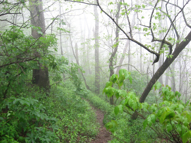
The hike began with high winds, cool temps, and fog.  While the fog limited my vistas, it gave a surreal quality to the hike. 
I came to the infamous side trail that seems to stump hikers on this trail. I’d read about it in Ernst’s book and also Ouachita Hiker’s recent comment, so I was ready for it!
It wasn’t too long before I discovered the trail’s namesake.  
I’d seen Red Buckeye blooming earlier in the spring along the Little Missouri Trail, but this is Ohio Buckeye, and is more commonly found in the northwestern and western counties. Beautiful! 

I made it to Katy Falls in time for lunch. Last time I was here I walked across the top of the falls, not this trip! 
After lunch I headed down to the junction and turned west onto the Caney Cr. trail. I hiked down the junction to the first campsite, to gauge the water, as Ouachita Hiker had suggested. It was pretty deep. I decided to hike back up to the trail and continued west and see how far I got. I forded the first crossing with ease, but knew they would get deeper the farther I went. By mid-afternoon I came to the first of a long string of crossings, waded across, and  hiked a ways then decided to backtrack to a grassy area I’d seen on a hill side to camp for the night. According to the topo I’d be spending a while creekside, and decided it would be buggy and there was a chance of rain, so I just felt wiser camping higher. I’d start fresh in the morning with all the crossings. This would also give the creek several more hours to drop out as well.


I made camp early with the intention of journaling a little, and just relaxing in the hammock. It was fairly warm, and I laid my quilts out to air, along with the bugnet, which I ended up not needing. 
Later I found a nice spot away from the hammock and fixed some dinner. I retired back to the hammock and prepared the tarp for the possibility of rain, which came, but only lightly and intermittently. I enjoyed just relaxing in the beauty of my surroundings and listening to nature.
As darkness set in, a couple of Barred-Owls chatted it up for a while, then just as I was about to nod off, I heard what sounded way too much like the scream of a cougar, thankfully far, far off. I wondered the next morning if I’d imagined it.
One disconcerting (and embarrassing) thing I realized while dozing in the hammock, is that when sleeping on my back, I snore! I know this because I startled myself awake several times! This is a most disturbing discovery, not to mention most unladylike!!

The next morning I awoke, had breakfast and spent the day making lots of creek crossings.
 I started the day in my wading shoes and didn’t take them off until I came to the last crossing before reaching the Buckeye Junction sometime after lunch. The water was still up and there were some beautiful scenes.

When I reached the Cossatot I chose not to cross it. I play it safe when I solo and I just didn’t see the benefit since there’s only a half mile of trail to the West TH. 

Along the western trail I saw several animals. The first night's site was on a nice grassy hillside and while sitting in my hammock looking over my map I heard a faint rustle in the grass and looked down. About 3 feet from me was a beautiful black Rat Snake making its way through the grass, oblivious to this person sharing its territory for the evening. I had stuck my camera in my backpack earlier. Curses! I retrieved it later, but not until I watched, mesmerized, as the snake moved out of sight. Earlier that same day I’d seen a juvenile cottonmouth on the trail, with its flat stumpy body. It was that time of year, and gave a whole new reason for watching your step. I have a healthy respect for snakes, but also find them absolutely beautiful!
Just before the Cossatot, I startled four does, and a bit later watched as a tortoise made its way through the woods.

This was my first hike into the west end and I really enjoyed it. Despite all the wildflowers in bloom last weekend, I wasn't able to find any umbrella magnolias or wild azaleas in bloom, but now here were the magnolias! We don't have this type of magnolia where I'm from and they are a delight to see, and unlike our leathery evergreen variety, the new growth of these huge leaves is soft and pubescent. They don't smell as nice as ours but they make up for it by having beautiful bark and branching structure.
I made my way east and by early afternoon crossed Katy creek, stopped for a snack, and ran into the first people I had seen so far. They informed me that some others were camped ahead. I had my mind on the campsite above the creek between the two crossings that were left, and was quite happy to see it was available. I guessed the others had chosen to cross the creek farther ahead, were another great spot is. With a hammock, you really don't need a campsite, but since the snakes and poison ivy was out, it seemed prudent, and I would just like to say I would love to hug the persons that put that amazing camp furniture (ie rocks) around the campfire ring, they were the perfect height for sitting and cooking and flat!!

I made camp, relaxed in the hammock for a while then treated some water for the hike out the next day and cooked dinner. I retired to the hammock and enjoyed the birdsong and peace and watching the sky change color and intensity. It didn't rain overnight and the next morning after eating and breaking camp I headed down the trail. Sure enough there were campers across the creek on the hill, but at 9 o'clock I didn't see them stirring. I hiked quietly by and about 15 minutes from the trail head ran into a father son team hiking with a beautiful well behaved black lab. The first thing they said to me was "what trail are you hiking?"  I wasn't sure what they were asking until we'd talked a while and they said they'd started at the Buckeye TH and taken a wrong turn, and ended up bushwhacking their way down. They weren't sure where the were. I re-oriented them and they decided to hike west, and camp at the junction then head back up to the Buckeye TH the following morning. I thought about them when the weather turned bad Monday and hoped they made it out before the bottom dropped out.
I continued on to the trail head and up the hill toward the car. My only disappointment had been that I hadn't seen any wild azaleas. Then lo and behold they were everywhere along the roadside! The wind was blowing and the shot isn't good, but they WERE blooming!
I love that they chose not to blaze these trails. It adds to the wilderness feeling, even though the trail is quiet obvious in most places.
This was a perfect weekend to spend in the woods, but likely the last for me this hiking season in Arkansas. Soon the weather will heat up, the bugs, poison ivy and snakes will be thick as thieves. It's funny, my original intentions were to switch over to canoeing now that summer's approaching, instead I find myself staring at the large map pinned to the wall in above my desk in search of cooler hiking venues.