Saturday, April 30, 2011

Cossatot River and Caney Creek Day Hikes April 16-17

Well the spring showers have begun and the rivers are up, much to the glee of the paddling world. It's been dry for so long. Thursday's storms turned violent over large parts of the south including Arkansas, and Friday was windy and overcast in its aftermath. I arrived at Shady Lake CG Friday mid-afternoon and had my pick of sites. Because of the wind I decided to camp on the Saline in the shelter of the trees. I car camped and got to try out my new POE sleeping pad. AWESOME! 
The Thermarest is now for sale :)


I'd missed getting to do the Eagle Rock Loop with friends the weekend before because of knee problems, and while I couldn't stand to stay home on this beautiful weekend, I'd decided to take it easy by just doing some nice easy day hikes and see how it went.


I got up early and headed for the north end of the Cossatot River Corridor Trail, arriving at 7:30 only to realize the day use area didn't open until 8. Park staff arrived to unlock the gates, I parked and quickly got on my way. So much for being an early bird. It was cool and breezy as I made my way south. I was hoping with all the rain the side creeks would be up and there'd be opportunities to see some waterfalls. What I did see were lots of wild irises in bloom.
My plan was to hike to Sand Bar and back, but when I got to Ed Banks, I decided it was not safe to cross. Silly me, I thought there was an actual bridge there, not a ford. I always err on the side of caution; it's a long way across, one slick spot could spell trouble, and I know a hydraulic when I see one. Instead I had lunch at the nearby campsite and headed back. On the way back I passed a couple of groups of college age kids and warned them about crossing. I recently checked the gauge for that day, it was over 4', having dropped out quickly from 8' after Thursday's storm.
 There were some great river views from up high and it couldn't have been a nicer spring day.

The CRCT is a nice trail and I've now done a section on the north and south ends. I don't care for all the blazes though. At one point on the trail I had each hand on a tree with a blaze. I recently found out that will be corrected in the future, as well as some backcountry camp sites added. There was a great deal of effort and sweat put into this trail and I hope to hike it in its entirety next fall.
My left knee had started giving me trouble again and I wasn't sure hiking Sunday would be possible. Grrr! Sometimes just getting off it overnight works.


The next morning I was up early again and heading for Caney Creek, having tested the knee out first on the hike up the hill to the restrooms. I strapped on the brace for good measure.
My first trip to Caney Creek was only six months ago. Leaf-off is a special time of the year when you can see forever, but Caney Creek in spring is simply amazing! One of my favorite trees, and there are many, are the umbrella magnolias. Not blooming yet, I find their branching structure fascinating and their newly unfolding leaves have a fairy like quality to them.
With all the tender new foliage, I felt like I was walking through a neon green cathedral. Just as I took this shot, a Barred-Owl flew overhead. How amazing to live in such a place!
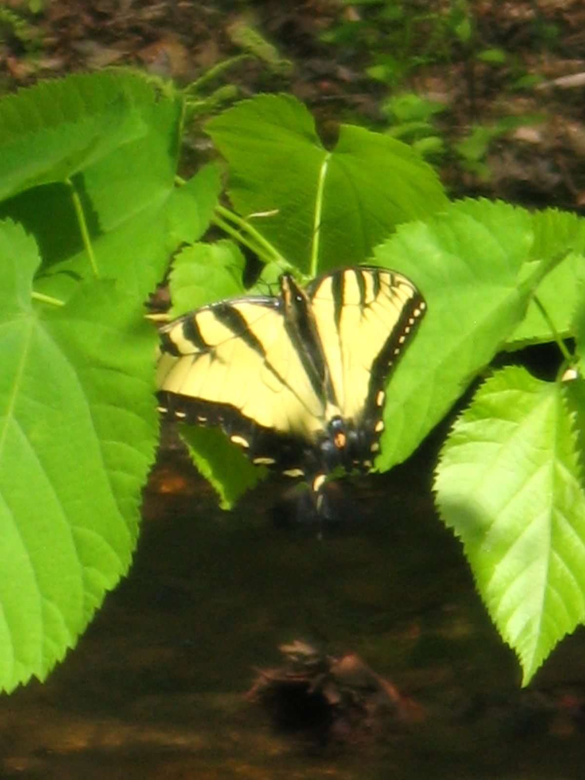
They wildflowers were blooming, and the butterflies were out in force. I hiked to the Buckeye Junction and back stopping to have lunch where the trail crosses Katy Creek.
I made my way back to the car, disappointed that I hadn't spent a night in the woods. As I drove home I began planning for the next weekend that would remedy that!
I'd passed another solo hiker during my hike; we were both in meditation mode, so we'd exchanged quiet greetings and moved on. I'd realize later, thanks to a note left on my car, that he was a fellow hammock camper and that we'd corresponded before on the HammockForums and I'd introduced him to the Backpacking Arkansas forum. Small world.

Saturday, March 19, 2011

Little Missouri River Backpacking Spring Break 2011

This was only my 4th backpacking trip and my first solo, although with it being spring break, it didn't really seem like a solo trip. I met folks from Oklahoma, Missouri, Mississippi, Indiana, Texas, four wayward boys from Louziana, (more about them later), even some folks from Arkansas. Met two separate young couples on the trail, both of which the women had shoe/foot issues. One was wearing flipflops, as her boots were killing her; it was her first backpacking trip. The second one was wearing a pair of Vibram 5 KSO's. Now I have a pair of these and they are NOT conducive to comfortable hiking in the Ouachita's. She'd accidentally left her boots at home. To her credit, she was on day three of the loop. Oh yeah, and Larry the Hiker Guy, a nomad living and working from his cabover camper while hiking all over the country. How cool is that!?
I had considered doing the whole ERL,and most that I met were, but after my left knee raising cain the weekend before the trip, I decided to play it safe.
After getting a late start from home and a short stop at a Walmart for knee braces, I hit the trail at 512 about 11:00. It was a beautiful day, albeit a bit warm. Before I got on the trail, four young guys (early 20's, I'd say) came over to ask me about the trail. They were from Lafayette, LA, and we had a nice conversation about one of my favorite parts of LA. They didn't have a map of the the loop, but I let them take pictures of my map with their cell phone. They were going to do the loop and be back to their car by Sunday night. Now, I really didn't think that was realistic, but hey they were young and who am I to judge? About that same time a family drove up and asked about Winding Stairs and the Falls....geez I was beginning to feel like a tour guide, LOL. It does amaze me that people don't bother to research an area before heading out. By 11:30 I was heading down the trail. I planned on spending the night somewhere on the other side of the falls. At Crooked Creek, there was a group of seven or so from Dallas, fly fishing for itty bitty fish. Well that's what they caught anyway. All in the group were novices, except for their guide, a young woman in her late 20's whose father guides flyfishing trips in CO. We talked a while and they said they were going on to Winding Stairs. I headed across the creek toward the falls, and in a bit they followed me. I mentioned they'd said they were going to WS, and they replied, "yes, but we're driving and our car's at the falls. I tried to get ahead of them, but the guide girl continued to ask questions about various things. I was beginning to think there was not going to be any solitude on this trip.
As I made my way through the falls day use area, it looked like a convention of ATV'ers. One of the guys made a comment about me packing solo, and I lied and told him I was actually meeting friends that had started at the upper trailhead, and that we were rendezvousing at a campsite for the night. I think they bought it. I hiked on about a mile and found a nice hillside to camp on above the river. The mosquitoes were out, so I was glad I'd brought the bugnet for the hammock. After a satisfying meal I fell asleep listening to the river's song and a barred-owl's call. One of the great things about solo camping is that I don't need to wear my earplugs...no one snoring around me, HA!  I dreamed of toenails falling off. HA, I'm still growing back a toenail from hiking in my boots at Big Bend. I have officially sworn off hiking boots except maybe in the dead of winter.


The next morning I got up at 7 left camp at 9 and ran into Larry the Hiker Guy. We talked gear and hikes for a bit, took pictures of each other, HA, then went on our way. Somewhere about a mile or so below the upper trail head, I ran into the Lafayette group coming back down the trail. This wasn't a complete surprise. One of the guys said he was sick so they were heading back. Well he did sound stopped up, but I suspect they misjudged their ability, or at least regained some sense of reality. Maybe they changed their minds after the first hill on the ABF. I didn't ask them how far they got.  I told them I'd think about them the next time I made it down to south LA. I arrived at the upper TH at 11, stopped and had lunch before going back the opposite direction. I passed a boyscout group from Mississippi, with boys ranging from maybe 8 to 12. I talked with a couple of the adults about the Sipsey, and they commented about hiking around Red River, NM.
I wanted to be somewhere back on the other side of Crooked Creek for the night. I made it to game plot 70 for the night. The sky had been overcast all day, which kept the heat down, but I knew there was about a 70% chance of rain for the night. A group of college guys from Denton passed as I was scouting trees for hanging. I can't get over how hard it is to find trees that aren't dead or have dead branches overhanging. I collected water for the next day and while walking along the river, found a beautiful creek, or maybe spring spilling over the rocks on the opposite side of the river.
It was cool enough not to have to use the bugnet, and after dinner I slipped into the hammock, but not before lowering the tarp sides and setting my backpack under it for the night. Somewhere around 1 AM it started to rumble and by 2 AM the storm hit.  The lightning was loud and near, but not so near as to scare the bejeezus out of me.  I'd found a spot below several ridges, and away from the tallest trees.  It's a great feeling to sleep in a hammock in a thunderstorm, and I was quite pleased that I stayed high and dry. Although I did dream of floods.
The rain was gone by morning, but the wind was blustery and cold, so I donned my raingear to stay warm. I am very impressed by how well they block the wind.  I headed down the trail about 9. Not long I heard the sound of an ATV, then came upon a campsite, that judging from the size of the two tents, were not backpackers. A guy and girl with a blue healer, were making breakfast as I walked by and said hello. The dog began to bark and run to me, I closed my hand and let him sniff, then deciding I was not a threat, proceeded to jump up on me, muddy paws and all. Fortunately, somehow he didn't tear my DriDucks, but nonetheless it ticked me off. I don't allow my dog to jump on people. I have no doubt the dog was smart enough to learn this, just guess the owners weren't smart enough to teach him. Needless to say they didn't apologize.
As I walked away I heard the ATV approach the camp. I know there is a FS trail to the game plots in this section, so I'm guessing that's how they came in.
I arrived back at 512 about 12 (actually 1 PM, with the time change that I forgot about). It was windy, grey and cool, and I was ready for a meal. I was also concerned about a noise that had plagued my right front tire on the trip up, so I headed to DeQueen, found a McDonald's, got a fish sandwich combo meal, stopped at a tire shop and had my lunch while they tried to remedy the problem. After that I stopped at the Walmart to buy a cheap watch with a glow in the dark face, and return the knee braces since they were too small. I then gambled and didn't get a larger size.  I started to head for Shady Lake campground then decided for a dollar more and the certainty of a nice hot shower, did I mention it was hot and sticky on Sat.? PU, I was standing in Walmart, wondering what that stench was....then I realized it was me! I dialed up Tom at Dierks Lake campground to check and see if he had room, and I was on my way. Boy is that water hot!! Just what I was hoping for.


Early the next morning I headed back to 512 to head in the opposite direction. Not counting 5 miles of upper ABF (the hard part), the only other part I had not hiked was the section between 512 and theWinding Stairs TH junction, and my plan was to hike down to the river crossing, have lunch, then putter around, make camp somewhere close to the river, and hike out the next day. I had considered crossing the river and continuing down, but was fairly certain the Winding Stairs area would be overrun with people, and I didn't really care about camping on the Viles Branch trail. I also wasn't completely sure I could negotiate, solo, the 3 ft bank at the river crossing. If the trail hadn't been so crowded I probably would have, but the rewards on the other side just weren't worth it this time. I did however have quite an entertaining show at lunch watching the boyscout group from Mississippi crossing the river. Talk about chaos!! What a hoot. 
After lunch I walked on down the trail past the crossing and found another beautiful creek flowing into the river complete with falls. After spending about an hour or so here I headed back up the trail, passing some day hikers. I hiked back up the hill to a campsite I'd seen on the way down, but after inspecting the trees a little closer, decided to backtrack back to the glade above the river, and made camp there. I didn't want to take up a designated campsite, nor did I want to camp too close to one, I spent what seemed to be an hour trying to find a decent place to hang, and finally found a nice spot above the river and set up the hammock. This exercise made me realize all the times as a tent camper that I never gave much thought to widowmakers. I sure do now. The weather was still cool, so I hadn't brought the bugnet this trip, and didn't need it. About 5:30 a small group of hikers passed by, on their way no doubt to Winding Stairs. After dinner I sat watching the sky change and the river flow. The day hikers I'd seen earlier were making their way below the bluff along a gravel bar in the river, and then crossed to the opposite bank and disappeared into the woods.


The next morning while having breakfast a small herd of whitetails came through camp on their way to the river. Seeing me, one of them began to snort a warning to the others, and there was a moment of chaos before they made their way down to the water. I left camp at my usual 9 AM, crossing Blaylock Creek around 10 or so.  Somewhere near where 106 and the trail run parallel, some campers had left a smoldering campfire, which I spent the next 20 minutes putting out. People absolutely amaze me!  And since I'm on a rant, let me also add that if I had packed up all the trash I found while on this section of ERL, the weight of my pack would have easily doubled!!! Disgusting to say the least. And while I adhere to a leave no trace philosophy, I'll be damned if I'll pick up after others! At least not while backpacking. I did entertain the thought of dayhiking for the express purpose of trail cleaning, but I seriously doubt it would have the slightest impact.  It was while I was making my way back and forth from the campfire to the creek (less than 25 ft away) that the inside of my right knee started bugging me, and by the time I made it over the hill at Albert Pike, it was definitely hurting. When I got to the car, I decided a good meal was in order (man I love that I can eat anything I want after a hike!!) I drove to Mena and had possibly the best vegetarian quesadillas I've ever had.....maybe I was just really hungry  :)
From there I decided to have another shot at the Talimena Scenic Hwy, since last time it was too foggy to see a thing. This time it was so windy I had to hold onto my cap! I made a big loop south and back east toward Shady Lake. My plan was to hike the trail around the lake the next morning to see how the knee was doing, and if it held up to do the Buckeye Loop Thurs/Fri.
The trail around the lake is very nice, although not very well maintained, and was hard to keep the trail at times, especially once it gets past the interpretive loop, but also just after it heads away from the lake. By the time I finished the knee was not happy.


I decided to drive east to the White Oak Lake SP, to try a flat trail that Tim Ernst mentions as worth the drive. I was also considering spending the night there, but once I saw how close the campsites were, decided to just hike and head home.
After talking with the gal at the park office, I discovered they'd added an extension to the trail, a new 9.8 mi loop called Fern Hollow. At the 1/2 way point are 4 pretty nice primitive campsites. I was tempted to hike in and stay the night, but it was 80 degrees, I'd already unloaded my pack, and I didn't trust me knee. Turns out it was a good call, I did the 3 mile Beech Ridge/Coastal Plain loop and really struggled with my knee on the last 1/2 mile. So, at about 5 PM I headed back home.
It was a great week, despite the traffic on the trail, and my knee. I was a little disappointed that spring wasn't more apparent in the wildflowers blooming; the next week or two should be much better. I was also happy to come away without any ticks and only one mosquito bite.
Now I've got to seriously work on both knees to get them ready for the full ERL in three weeks! Link to pics
https://picasaweb.google.com/liveoutsidelady/LittleMissouriRiverBackpackingSpringBreak2011?feat=directlink

Saturday, December 25, 2010

Big Bend again, the trip that almost didn't happen

Prologue:
Christmas break couldn't come soon enough as I planned my second trip to Big Bend. I gathered gear, watched the weather, added gear, subtracted gear, and jotted down various itineraries.
What I hadn't planned on was a trip to the ER three days before my trip. I'd had a episode the day before; felt like someone was sitting on my chest and my heart beating like the proverbial big brass band. It passed quickly and I made a mental note to call my doctor the next morning. I'd no sooner walked into work the next day when it happened again, this time the pressure went down my left arm.  I thought I might be having a heart attack, although I really didn't believe it, but I thought to myself, "this is how people die, they think it's nothing, it'll pass and then they pass." I wasn't ready to die so I let a co-worker drive me to the ER.
 They wasted no time in getting me hooked up to all kinds of stuff, throwing baby aspirin in my mouth and asking lots of questions. Well, I hadn't had a heart attack, the EKG, blood work, and chest X-ray all came out fine. I had to wear a heart monitor for 24 hrs to see if they could "catch it doing it again." Whatever "it" was. They had me lined up to see a cardiologist the next day, but because of a mix-up, that fell through. Thursday came and  I waited for the doctor's office to call. Friday morning I finally got the call, a stress test was in order, but they couldn't see me that day...could I possibly postpone my trip and come in Monday?  She put me on hold, then asked if I could be there in an hour.  ABSOLUTELY!

They'd just hooked me up to the monitor, when the tech exclaimed "yep, she's doin' it, no need for a stress test, go get the doc." By the time the doc walked in it was back to normal, but not before registering on the readout.  Ah, she said, SVT, then explained and said it was easily controlled with medication.  "So I can go to Big Bend?" I asked.  Yes!!!  Music to my ears!!!  She did however say I had to give up coffee. NO problem I thought, just get me on the road.
By the time I left town, got the prescription filled and made a quick trip to REI to pick up and extra platy, it was 5 PM and I was smack dab in the middle of MetroStress. It took me hours to get to the west side of Ft. Worth, and I didn't think I would ever get my neck muscles to relax.
Finally, I was heading toward Abilene, sweet Abilene, the song bouncing around inside my head.  It had been a long day and around midnight I pulled over at a rest stop just east of Big Spring. I slept three hours then headed west again.
I arrived in Marathon just as the Marathon Coffee Shop was opening, so I decided to give it a try.  Taking a seat close to the heater, I couldn't help but overhear a woman, possibly the owner, the sheriff, and a deputy all discussing the arrest of a man found the night before in the woman's house!  He had apparently been very drunk, became disoriented and had no idea where he was. It was quite entertaining, but I had permits to acquire, so I finished my coffee and headed out the door.


Day 1 Sat. Dec. 18th  Permits, Hot Springs Canyon Rim Trail and  K-Bar

When I arrived at Panther Junction, many back road sites were taken, so I chose K-Bar 2 for the first night, had to bump to K-Bar 1 the next night, Ocotillo Grove for  the next two nights, and Rattlesnake Mt. the last night to put me closer to Terlingua.

I headed down to Daniels Ranch to the Hot Springs Canyon Rim Trail. This area warms up more than the rest of the park and the weather was comfortably in the mid 60's but forecast for 80's the next several days. This trail has stunning views of the river, canyons and mountains. I arrived  at the springs, shed my boots and soaked my feet in the warm water.  I met a nice couple from Austin by way of Lafayette, La., and having lived in Austin, and spent a great deal of time in south Louisiana, we had a great conversation. Other than a few people at the springs, I didn't pass anyone coming or going. I hadn't taken my camera so before I left the area I drove to the springs and hiked up the trail to get some shots. It had been a beautiful day, albeit a long one. I drove to my campsite, fell asleep shortly after sunset and slept 10 hrs.

There was a full moon for this trip which meant the stars would be washed out, but what I didn't count on was that by camping on the east side of the Chisos, the moon would set behind the mountains long before daylight. I woke at 5AM and was treated to a Big Bend Sky after all. The stars literally twinkle like diamonds, and the shooting stars are too numerous to count. Words just can't describe it, it brought tears to my eyes.
  
Mileage hiked for the day 6.6


Day 2 Sun. Dec. 19th Banta Shut In,Windows Trail, lunch in the Basin and K-Bar 1

As the sun  rose and the stars faded, the birds began their day. K-Bar 2 is nice in that it's at the terminus of the road and Banta Shut In trailhead.  I lingered in camp, having my one cup of coffee and a bagel and cream cheese, then headed out for a morning hike. The silence is what I love most about Big Bend, and I stopped several times just to take it in.  Finally at 9:45 I head toward the Basin to hike the Windows Trail. Last year I didn't even make to the mountains to hike, so enamored with the desert was I. I ran into the couple from Austin again as they were finishing up the trail.

I have to say, having never eaten in the Basin restaurant, and hearing mixed reviews I was hesitant, but hungry, so I gave it a try. I had a veggie burger that was really very good and an equally good cold beer to go with it.  I noticed the couple from Austin on the patio and decided to go out and enjoy the warm sun as well and ordered another beer.  We got to talking about cougars and bears and our past trips;  it was a nice way to pass the afternoon. The were leaving in the morning, we said our goodbyes and I headed back to K-Bar 1. I vaguely heard the occupants of K-Bar 2 pass by after dark, but then all was still again.

Mileage hiked for the day 8.6


Day 3 Mon. Dec. 20th Lost Mine Trail, lunch in the Basin and Ocotillo Grove

I woke early, enjoyed the stars again, had breakfast, and headed back to the Basin to hike another trail I didn't get to last trip, the Lost Mine Trail.  It was a beautiful day to hike in the mountains, with beautiful vistas and cool temps.

I hadn't planned on it, but ended up back at the Basin for lunch, this time having the soup and salad bar, and again it was fresh and tasty.

I headed toward Castalon, stopping to visit with the ranger and have a look around. The parking lot at Santa Elena Canyon was swarming with people so I headed to my campsite.

I arrived at Ocotillo Grove late afternoon, and discovered mosquitoes, but it didn't take long for things to cool down and they disappeared. I wandered around the desert looking at all the animal prints, javelina, rabbits, bobcat, birds and mice. I sat and watched the moon rise over the mountains, enjoying the desert silence but for the occasional bird call and the hum of insects as night overtook day, then crawled into my sleeping bag for the night. About 2 AM I woke to nature's call and discovered it was strangely dark, then it occurred to me, the eclipse was taking place. I'd forgotten all about it. It was a great opportunity to view the stars in all their splendor but I was back asleep before the moon reappeared.

Mileage hiked for the day 4.8


Day 4 Tues. Dec. 21st Blue Creek Trail, lunch (you guessed) in the Basin and a late afternoon hike HSCR

I rose early to make the drive to Homer Wilson Ranch by sunrise to hike the Blue Creek Trail out to the Red Rocks and beyond. I was unprepared for the amount of traffic this trail gets. First I headed up to the ranch house and discovered a tent pitched on the porch. I slowly backed away, turned around to head down the trail and ran into a backpacker from Ohio, working in Houston, who hadn't wanted to pass up the opportunity of being relatively close. Not long after that I passed two more guys, one hiking my direction, and another that had just broke camp, and on the way back passed a group of kids heading to do trail maintenance, bless them! I only hiked a mile or so before turning back; this is an area better photographed for sunsets, and the gravel of the creekbed really calls for gaiters, which I did not own....yet. By the time I returned to my car the day was already heating up so I decided to forgo the Ward Springs trail until the next morning and once again headed to the Basin, with a cooler Laguna Meadows on my mind. It was almost noon when I hit the trail, and had only gone about a half mile when I decided it was just too hot to hike, it was almost 80*. Instead, I headed back for lunch...this was becoming a habit!  I relaxed in the shade on the patio for a while waiting out the heat and planned what to do with the rest of the afternoon.

I hadn't planned on going back to Rio Grande Village, I'd considered Grapevine Hills, but as I lounged on the patio with its view of the mountains, I started thinking about how nice the river canyon vistas on the Hot Springs Canyon Rim trail would be in late afternoon light. I drove back down and hit the trail at 4:30, giving myself an hour to hike out and another hour to hike back before dark. I hadn't been on the trail long before a couple of young guys, somewhere between 16 and 20 (gets harder for me to judge the older I get) passed me on the trail. One had a huge telephoto lens on his camera. Turned out he was a birder.  They asked me if I happened to know what time it got dark and about the length of the trail, we talked a bit and I told them I was only going as far as 5:30 would take me, then turning around to get back by dark. We swapped lead several times as we each stopped to take in the view and get a few shots. Finally I turned to head back. They kept going toward the springs, and I asked them if they had a headlamp, well my exact words were "you guys do have a headlamp right?" No.  I joked, not wanting to sound motherly, "well there's a full moon tonight and no eclipse, so you should be fine, just watch out for rattlesnakes." It wasn't too long before they caught up and passed me going back. They stopped for a while to call owls, and were successful. We listened for a while, making it back to our cars just at night fall.

It was a loooonnnggg way back from there to Ocotillo Grove, but with the a huge moon rising over the mountains and seemingly changing places as I rounded each bend, it was quite a show, and I saw a couple of gray foxes along the road as well. It was about 9 PM when I made it back to camp. I was asleep almost immediately, deeply satisfied by another day well spent.

 Mileage hiked for the day 5.5


Day5 Wed. Dec 22nd   Luna's Jacal, Chimneys Trail West, Rattlesnake Mt., The Starlight, the Wind from Hell, and the Border Patrol.

I roused about 2 AM a little cold, added some layers, including my down booties, zipped up the bag, burrowed in, cinched the hood over my head and almost slept past sunrise! I woke with a start, jumped up, grabbed my camera with tripod attached, sans eye glasses, left the car door wide open, as I would discover upon return, and started walking out across the desert toward Santa Elena Canyon. It was cold and I was grateful for having added the layers. I'd gotten "the shot" last year of sunrise in the canyon, but thought a shot from Ocotillo Grove would be a pleasant reminder of my stay here. I didn't get "the shot" because "the bird" sidetracked my attention. Oh well, I was standing in the desert, the sun rising on another beautiful morning,far away from the madness of civilization, it was all good.
I walked back to camp, had a leisurely breakfast, enjoyed the birds and the warmth of the sun. If not for the impending midday heat, I could have sat there all day!
I had planned to get up early and hike to Ward Springs but decided instead to relax and enjoy my campsite since I had not seen it in daylight except the first evening I'd arrived. (This is the problem of having only 5 days and so much to see and do.) It was so peaceful, and after 4 days of hiking and photographing everything in sight, I was ready to slow down a bit.  I sat a while longer, then headed up the Old Maverick Rd toward the Chimneys Trail West. It was a lot closer than Ward Springs. I'd hiked it from the east to the Chimneys last year, so I thought it would be great to hike it from the west, even for just a few miles, since it was going to be warm and I wasn't exactly getting an early start. I stopped to get some shots of Luna's Jacal, and then headed to the trailhead.

It was 10:30 and I figured I'd hike out an hour and back to return by 12:30. The mid-morning sky was bright and clear with Santa Elena Canyon in the distance as I walked and reveled in the silence. As I looked down as I stepped down into a draw I was mildly puzzled as I noticed the sand was damp, then I looked ahead and saw WATER! At first I thought it was just pooled, but on closer inspection realized it was flowing. I was surprised since the guidebook states that "depending on rainfall the springs water sometimes runs down the draw"...a running stream was the last thing I expected to see since there had been no rain since September! I hiked out a little longer, then turned around.  I stopped at the draw to soak my feet in the cold spring water and wet my bandana. The day was not destined to get as warm as the previous and a faint breeze kept things cool on the way back.  I made it back just a little before 1 and headed to my campsite at Rattlesnake Mt.

When the weather is cold, as it was last year I didn't even consider bathing, just used my wet ones, but with the heat, and the fact that I was planning on going to the Starlight that evening,  I'd filled my water jugs at Rio Grande Villlage the day before. After a quick bath and clean clothes I let the sun and breeze dry my hair and headed toward Terlingua.
I'd planned to putter around town before the Starlight opened, have an early dinner and head back to camp since I would be leaving at daybreak.  The Leapin' Lizard had a sign on the door saying she was closed from Dec 20-27.  I was disappointed as I had heard that Thomas Avery had some of his photography displayed there.  I headed over next door and milled around in the book room and contemplated buying a beer and sitting on the porch.  Instead I drove to the Barton Warnock Visitor Center.  They had a wonderful interpretive exhibit and a lovely desert garden area.
By the time I had completed the tour it was time to head to the Starlight.  I got a table, ordered the guacamole and a beer. When the waiter brought it out he mentioned that Butch Hancock was planning that night.  Well, I hadn't heard him with or without the Flatlanders in a long time, but I'd arrived too early to hear him play, even if he was to start at 7.  I told the waiter I'd work on the guac and the beer and maybe order something else to eat later.  I walked down and had a look at the art exhibit.  I'd brought my notepad to catch up on my journaling, and about an hour later finished the beer and guacamole and ordered a margarita and dinner. About this time the restaurant got slammed. A large party of 30 had to be set up on the dance floor since they already had an 18 top in the middle of the dining room.  I'd just placed my dinner order when it all hit and I figured my meal would come out cold and wilted since it would likely sit in the window in the kitchen until the poor only waiter in the place finally got to it.  What actually happened impressed me and reminded me of my own table waiting days long ago.  From what I could see, there were only the following: one waiter, one manager, one bartender and two cooks. From this ensemble they worked like choreographed dancers. The manager helped take the orders on the 30 top, as well as other tables; thankfully as the restaurant began to fill, the 18 top didn't materialize, and those tables were quickly separated back into 4 tops. The bartender picked up tables without hesitation, and one of the cooks delivered food to tables.....it was a beautiful thing! My second margarita arrived, and my food followed shortly, everything perfectly fresh and delicious!  I remembered the reviews I'd read about the restaurant, some good, some not so much, and thinking that I'd have to write a review on this night myself.  The meal wasn't the end of my night though. By the time I was finishing my dinner, about 6:30, in walks Butch, his wife and teenage kids in tow....well hell, I thought, I can't leave now. He started promptly at 7 and I promised myself I would listen to one set. I moved to the bar and was enjoying the music when a gentleman sat down next to me. He shortly asked if I lived in Terlingua, I said no, I was just visiting the park. He and his wife had moved from Asheville, NC to Texas some time back and had built a solar home sans telephone, tv, and computers, north of town. They also had a home in Cristoval, south of San Angelo, since we old farts need to be less than 100+ miles from a hospital. He mentioned the Black-Eyed Pea Cook Off on New Years Day, and that he'd won first prize the last two years, but figured he'd lose his title this year. We talked a while longer and eight o'clock finally rolled around with the end of the first set, and it was time to go. I shook hands with my new acquaintance and headed out the door.

When I reached camp, the wind was howling (I'd recalled then a comment at the headquarters about the wind here) it had even ripped my permit from the post which I had carefully attached by the wires. I felt terrible, me with a Leave No Trace bumper sticker!!!! I had left a trace and it was, in all likelihood, already in Mexico by then. I briefly considered wandering around the desert to hunt for it, then thought better of traipsing around amongst the rattlers.

I woke up at 3 AM, unable to go back to sleep, and decided to get an early start on the trip home. As I exited the Old Maverick Rd. I passed a Border Patrol, which promptly pulled in behind me and followed me (all the while checking my plates, no doubt) and soon the lights flashed and I pulled over. The woman was cordial, but not smiling. She asked me where I was going, and why I was coming off the OMR at 3 AM....Well I could see her point, as I explained I had camped at Rattlesnake Mt. that night. It then dawned on me that I had no permit to prove this. Fortunately I didn't need it. I told her I had a long trip home she asked if I was leaving the park via 385. I thought this was strange since that was the only route I was aware of out of the park, since I'd long passed the west entrance to the park. She let me go, telling me to have a safe trip, but I was imagining as I drove that she'd probably radioed ahead and they were just waiting to turn my car inside out. Instead, the young man  greeted me with a smile, asked me how I enjoyed the park, asked me to roll down my back windows, we chatted about the park for a moment and I was on my way.   I made the drive home in 12 hrs, collected the dog and headed to the house.

Mileage hiked for the day 4.0
Total miles hiked for the week 29.5


Epilogue:
First, I want to thank everyone on Big Bend Chat that have generously shared their experiences, pictures, and  information. Without their guidance my trips would not have been nearly as wonderful. Because of them, I hope to spend a lot more time in this amazing place.

This being only my second trip to Big Bend, I'm still moving too fast, trying to see too much.  Part of it's my obsession to hike,  part of it's just the wonder of the place. I look forward to future trips when I can spend more time in one place. There's just so much to explore.

What I learned from this trip.
There's no need to buy souvenirs, Big Bend pinstripes are all the reminder of my trip I need.
Note to self: pay attention to where you are driving when gazing upon handsome buck muley's on the road to the Hot Springs (left side).
Second note to self: pay attention to where you are driving when looking over your shoulder out the side window to see if Santa Elena Canyon is in position for the "perfect" morning shot (right side.)
During a full moon camp on the east side of the Chisos.
Buy gaiters.
Bring the backpack.

 
Link to a few of the many pictures I took.
http://picasaweb.google.com/liveoutsidelady/BigBend2?feat=directlink

Sunday, December 5, 2010

Little Missouri Trail & Tall Peak

Nothing takes the edge off the daily grind like spending time in the woods, which is why I decided at the last minute to take Friday off and head back to Arkansas. I got up at 3, left before 4 and 200 miles later at 8:45, was heading across the upper Little Missouri Trail where it meets the Athens Big Fork. It was 33*, but was forecast to climb to the mid 60's.

I decided to try out my new water crossing shoes. They're AquaSprints and they worked perfectly; easy to get off and on, a sole thick enough to be comfortable with good traction, and they were $3 and weigh about 2 ounces. I am not a gram weenie, I am not a gram weenie, ok I am, but I have to be, I'm getting old :) I carry a small square of quick dry camp towel to dry my feet, put shoes and socks back on, slip the shoes and towel back into the side pouch of my pack, and carry on.

The weather and the scenery was beautiful and I stopped a number of times just to listen to the river, or the quiet, or the trees, or the birds. The river, while narrow up this far, is clear and beautiful, and I could sit beside it for hours.

There are several campsites along this section and one in particular caught my eye, as someone had set a large flat rock atop an tree stump to make a lovely table.
I hiked through the rec area to the falls, then back to a picnic table next to the river to have lunch. I did not see or hear another soul the entire day.

Driving back down the road to the falls rec area, my path was blocked by a beautiful rat snake sunning itself in the middle of the road. I got out of the car and had to gently prod it with my hiking pole to get it to move off the road. I love snakes and spent a few minutes photographing it.

I stopped at the falls to get a few pics as I didn't take the camera on this hike, and headed back to Dierks Lake and a night at Tom and Janet's campground. I enjoyed a nice chat with them then excused myself to go try out the hot showers Tom had promised...ahh, was he right!! I hope they never get the idea to put a timer on it! After reading a few paragraphs I was out for the night. My only regret was that it was dark when I finished my shower and I left before light so I didn't get to really take in the campground which sits on the Saline River just below the dam.

Day 2 and a peek at Tall Peak
The last time I did this hike the mountains were shrouded in fog, so there were no views of distant peaks. It's nice to hike in different kinds of weather and get a different perspective. It was 8:00 and 44* when I started up the trail. The campground is closed for the season so I began across the bridge from the last river crossing.

Hiking in the Ouachita's means hiking over rocks, Arkansas Novaculite to be precise, "razor stone" in latin. The rock was chipped for arrowheads and is a source for whetstones. For a solo hiker this means paying very close attention to where you step, especially with drifts of fall leaves layering the ground. It does present a wonderful lesson in geology though, and it's fascinating what you see along the way. Since you have to have your eyes on the ground it's nice to have something cool to look at!

As I made my way up the trail the vistas that were hidden before were now popping up everywhere. One thing that shocked me was horse manure on the trail...I can't believe someone would risk injury of an animal to go up this trail, especially toward the end. Even with a mule I wouldn't attempt it. But that's just me.

Hiking back down I stopped to have lunch at an outcrop, taking in the views and watching in awe as leaves floated up and down, caught on the thermals. It was like a watching a bird.

After relaxing and literally staring out into space, I continued down the mountain and back to the car, to make the drive home. As I drove past the campground I watched as a flock of wild turkeys made there way through the woods.

As I drove home, I was already planning where to hike next when I make it back to Arkansas. I think the Buckeye/Caney Loop is next on the docket :)

link to photos http://picasaweb.google.com/liveoutsidelady/LittleMissouriTrailTallPeak?feat=directlink

Thursday, November 25, 2010

Return to Caney Creek

My first time to visit this area was Halloween weekend when I joined Trailrelic and his friends to backpack. It was my first backpacking trip. Well needless to say, I was hooked, not just with backpacking, but with the Caney Wilderness. Until recently discovering the forum, I'd really focused on the Buffalo area, and didn't realize this area was only 4 hrs from my front door to the trailhead.

November 20-23, 2010

I drove up Sat AM, picked out a camp site at Shady Lake (I was the only inhabitant of loop C) and then proceeded to hike the Tall Peak trailhead, which for anyone that doesn't know, it's right in the park. It was nearly 11:00. As many of you know it was very foggy; I knew the "vistas" would be non-existent, but I was hiking simply for the pleasure of hiking so it didn't matter. I brought the camera and took a few pics before I began to ascend the trail. It was wet and slick, so the camera was packed away and I continued on up the trail. There's nothing like walking alone through the woods in the mist. I only hiked about 2.5 miles up (trail is 3.2 mi. one way) I realized that I hadn't seen a blaze in a while and remembered Tim Ernst's comment about a trail "you don't want to take) it was getting a little steep, was wet and slick, and I don't take unnecessary risks when I solo, so I turned around in hopes of finding where I'd turned wrong. Well it turned out I hadn't gone wrong, but apparently after talking with Ed and Tom the next day, someone had started repainting the blazes, but possibly didn't get finished. At that point I decided not to go back up, there really wasn't anything to "see"...fire tower? I don't see a fire tower :) Looking down into the Caney Wilderness area was beautiful though.

I got back to camp, ate, and set my hammock up near the water, settled in with a book and read for a while. Just after dark the coyotes serenaded, something, probably a deer, went thrashing into the lake, and later something dropped loudly from a tree with a hollow thunk into the water. Ah the sounds of the night. Even though there was cloud cover, the full moon illuminated the night sky.

The next morning I listened again to the weather radio, ate a leisurely breakfast and proceeded to get ready for a day on the Caney Cr. Trail. I opted not to take the camera.

I reached the east trailhead at 9:30, and proceeded down the trail. I passed a group of kids and chatted with them for a bit, then later I ran into Tom and Ed, I'd met Ed on the last trip, and it was very nice to finally get to meet Tom. We chatted for a bit, then we headed in opposite directions. I walked on, taking in all the beauty of fall. I didn't see anyone else the rest of the hike, although there was a large group camping somewhere, maybe Katy Falls, according to Tom and Ed. I checked the time and the time I'd left, walked a little longer, then a little before 1:00 turned around to head back. Coming back I found the Hippie tree that Tom had described earlier; I wouldn't have noticed it otherwise, and I'm not sure I'd have made out the "hippie" seems like Tom said it was done many years ago. I was back at the trail head by 3:30, drove back to camp to have dinner around 5. I decided to take a chair and sit down at the edge of the lake to eat and I'd just been sitting there a minute, taking in the late afternoon quiet, when I noticed two white things in a tree across the lake. They were on the same plane, just several feet apart which seemed odd. Now I wear glasses but even with them I couldn't tell what it was, but I had an idea. I went and got the camera and zoomed in and sure enough it was a pair of eagles. They only allowed me a couple of shots before they felt intruded upon and flew down to the opposite end of the lake, but it was a pleasant dinnertime surprise.

The next morning (Monday) I awoke to light rain, listened to the forecast, and decided to postpone my Little MO hike until another time....Tom and Ed had decided to leave due to imminent rain, and I didn't want to get caught crossing a rising river. This area is new to me and the thought of last June still haunts me. So I headed for dry land. I spent a night at Lake Catherine, because I'd seen in Tim's book they had almost 10 miles of trails. I was only able to hike 5.5 because the other 4.5 was closed because it's adjacent to a deer lease.

Tuesday I awoke again to light rain, but I just couldn't go home, I considered a few options and decided to backtrack, and head to QWSP. I thought it might have some trails, and I'd never driven the Scenic Talimena Hwy.
I drove along hwy 8 to Mena, and headed up the road to the state park. It was about a mile or so up that I encountered the heavy fog bank, with 20-30 ft visibility, I would catch a glimpse of a "vista" sign as I passed each, it was downright comical and I should have taken a picture just for fun!
I drove up to the lodge, but it was a ghost even from the road that encircles it. I drove back down and decided I'd just go and check out Little MO Falls but by the time I got down hwy 71 and to the turn off, the cumulus congestus clouds were forming fast (it was about 78* by then) and I knew a thunderstorm was only a short time away. So with much reluctance I headed home, all the while planning where I could continue to hike farther south where maybe the front would hold off for a while......I decided to wait for the rain to pass and try an area close by this weekend......

I wished I'd gone hiking instead. While walking my dog last evening, we came upon a domestic bunny that either escaped, or someone "set free", white with dark grey nose, tail, feet and ears, it stuck out like a sore thumb against the yucca it was nestled under. It would soon become a meal for either a coyote, bobcat, hawk or owl, we've even had two report/sightings of a cougar. I took the dog home, came back with a carrier and the bunny hopped right in...as I type this I have a bunny happily munching veggies in my bathroom....now on Thanksgiving day, I have to try to find a friend that has some coastal hay! I put up flyers and emailed a rescue group and I think they can help me (for a price) I just couldn't leave it....another casualty of insensitive, thoughtless people...then again it actually could be that someone is pining for it.....I hope :) Here's a link to the few pics I took.

http://picasaweb.google.com/liveoutsidelady/CaneyCreekWildernessArea?feat=directlink

Friday, November 12, 2010

Backpacking

I took my first backpacking trip a couple of weekends ago, it was wonderful. Part of the thrill was in the planning; researching, weighing, developing spreadsheets, comparing others gear lists.
This latest obsession began to evolve after I bought a new camera last fall. I had given away all my old SLR gear long ago, but hadn't replaced it. When I started to research, I decided that I really didn't want to go full blown, so I settled on a midway Canon SX10IS. It all started with a buck in my yard. I just needed a little more telephoto than what my little point and shoot had. Anyway, I decided that the new camera was a good excuse to take a couple of fall days off and head to the Upper Buffalo (pics of this trip are on my link below that trip report.) I hiked quite a bit that trip, and decided for Thanksgiving to head to the Hill Country and hike some more (also in another trip report.)
Then there was the Big Bend Trip (ditto.)
All the while I was hiking these trails a wisp of an idea began to grow. I had never seriously considered backpacking since I have a badly abused back, and I had neck surgery just a couple of years ago. However, the wisp continued to grow until it became a cloud. You know one of those clouds above a persons head when they get an idea. Well it was a fairly grandiose idea, but I couldn't shake it.
So, I began to research. The internet is a wonderful thing (even if it is changing the way my brain works, and my powers of concentration are going to hell.) It can't be beat for research! I visited all kinds of ultralight backpacking sites, not to mention all the forums; BackpackingLight, the Hammock Forums, White Blaze, Big Bend Chat, etc.
Boy what a wealth of knowledge out there. Well before you could say ultra light, I was buying new gear,weighing, making spreadsheets, and about a year later was ready to start training. This was the true test, could I actually sustain a trip, even a short one carrying all my gear on my back???? Well I started light, then added over time until I was hiking up to 4 miles in the morning before work with a loaded pack. But what about a real hike? I decided to join in on a hike to the Caney Cr. Trail in SW AR. It was an easy trail, about 5 miles per day and surely would give me my answer.
It was a wonderful trip!!! Albeit with a large, noisy, yet fun group, but it gave me the opportunity to further test my gear, and go into an area I'd never been to. I carried the pack with ease. The only thing I hadn't planned for was the dayhike after setting up camp. I didn't have a way to carry water, but I've since remedied that, and I now have a carabiner to attach my pack to the tree where I hang my hammock. I did have an extra piece for prusik line so I was able to attach it to a tree, but those were the only things I didn't foresee. I can't wait to go back!

Tuesday, September 7, 2010

Dark skies, clear skies, a rant

Am I the only person that can't stand power lines??? I mean I really hate them. They are pollution of the worst kind in my opinion. I'm trying to get a great shot of an amazing storm cloud brewing and there in the photo they are...they're inescapable, everywhere you look. That's what I love about wilderness. I love driving to Big Bend and watching the lines disappear. I know there are still a few, but you can see for miles without them.
And what is wrong with all these idiots that leave outside lights burning day and night! Are they afraid of the dark??? I mean it's not like we are in the middle of the wilderness, and even if we were what good does a light burning bright all night keep them safe from??? OK, I can see needing a light to see from the front door down the stairs to the car, but that's what they make sensors for. Just another source of pollution!!
OK, that's my morning rant, have a great day :)